Screenshots |
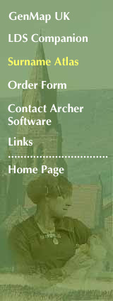
ScreenshotsThe program runs as a fixed-size window of 1000x700 pixels. This window is divided vertically into a number of tabs (at left) and a map of the UK at right. The screenshots that follow illustrate different aspects of the program. Data Entry tab
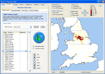
Note the radio buttons and check-boxes above the map image. These allow various combinations of display options - grouping the data by county or by poor law union; and showing the data 'actual numbers' or 'densities'. The four buttons arranged in a diamond shape are used for panning the image. The screenshot also shows how you can zoom in - the cursor has been dragged across the map to create a rectangular area defined by a dashed line. When the mouse button is released, the image will be zoomed to the area of highest Earnshaw density. Configuration tab
The surname shown is Prescott. Labels have been added to indicate the names of the poor law unions, revealing that Prescot (where the surname originated) and Wigan still have the highest number of people. The 'Feather Coastline' option has been selected, which plots the sea not as a uniform block of colour, but as a blue gradient fill around the coastline - handy at print time for saving ink! Results tab
Print tab
Note that this time the map shows the distribution of a forename, Charles. Print Preview
1 March 2011 |
 On this first screenshot you can see the Surname tab is selected. 'Earnshaw' has been typed into the 'surname edit' box, then the large 'Display' button clicked, revealing a map for that surname. The scrolling list at left shows this surname, as
well as other surnames in the alphabetical sequence.
On this first screenshot you can see the Surname tab is selected. 'Earnshaw' has been typed into the 'surname edit' box, then the large 'Display' button clicked, revealing a map for that surname. The scrolling list at left shows this surname, as
well as other surnames in the alphabetical sequence.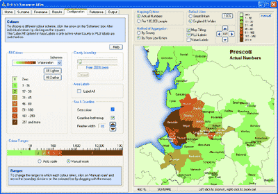 The next screenshot shows the Configuration tab selected, with a number of options allowing control over the colour scheme used, and the numerical range boundaries.
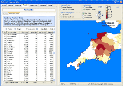 On the left you can see a table of figures. This Results Table shows the number of instances of the currently mapped surname - Newcombe - in each Poor Law Union.
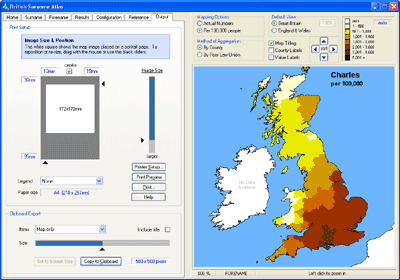 Here you can see the Print tab, which has facilities for controlling the size and position of the printed map on the page. The dark grey area represents a sheet of paper, the white square shows where the map will appear. The small section of the screen at bottom left controls exporting to the Windows clipboard. A slider control allows the bitmap size to be varied.
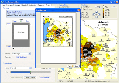 Superimposed on the program screen here is the Print Preview window, which gives an approximation of how the printed page will look. Titling for the map is generated automatically, and a legend has been selected to appear in the bottom right corner.